Introduction
In June 1819, Stamford Raffles, an officer with the English East India Company (EIC), made the second of three visits to the trading colony he had founded in February that year. In correspondence to his superiors, he expressed a steadfast belief that Singapore, an island at the tip of the Malayan peninsula, would succeed as a trading port by virtue of its pivotal location on the narrow Malaccan Straits straddling the Bay of Bengal and the South China Sea. ‘Our object is not territory’, he wrote, “but trade … a great commercial emporium and a fulcrum whence we may extend our influence’ (Letter to Colonel Addenbrooke, June 10, 1819, from Turnbull 1989: 20). It is widely acknowledged that the colony continued to develop in accordance with Raffles’ vision long after his untimely death in 1826. The celebrated writer Jules Verne recalled in his travelogue of 1881 that Singapore had become ‘one large warehouse’ through which exotic goods all over the world flowed: ‘Madras sent cotton cloth; Calcutta, opium; Sumatra, pepper; Java, arrack and spices; Manilla, sugar and arrack; all forthwith despatched to Europe, China, Siam’ (Verne 1881: 279). The abundance of goods was an indicator of the vast amounts of capital and people arriving and contributing to the port city’s development in the late 19th century. A crucial component of the colony’s success was its administrative governance. The American zoologist William Hornaday was so impressed by the colony’s management that he compared its bureaucracy with a writing desk: this ‘handiest city’ had been ‘well planned and carefully executed as though built by one man … like a big desk, full of drawers and pigeon-holes, where everything has its place, and can always be found in it’. He described at length how the port was designed to impress upon visitors its reliability while physical renewal kept pace with economic development. ‘Architecturally considered, Singapore has little to boast of except solidity and uniformity’, he observed; ‘it is a two-story town, solidly built of bricks and perfectly innocent of style … but [with] a scarcity of the tumble-down, drunk and disreputable old buildings in other cities’ (Hornaday 1885: 294).
The accounts of 19th-century travellers such as Verne and Hornaday were remarkably consistent in their descriptions of Singapore as a bustling trading port sustained by the rapid circulation of commodities and an adequate physical infrastructure. Trade figures in annual government reports corroborated these accounts, evidence of the colony’s reputation as one of the world’s leading ports by the turn of the century. However, statistics only capture one aspect of Singapore’s economic success. Photographs of the urbanised colony and prints of port activities that provide convincing visual representations of endless, intense trading activity constitute some of the most pervasive imagery of 19th-century Singapore. Many buildings featured in these images are godowns, standardised warehouses used to store goods cheaply and safely. They were the key architectural interface between the city’s economic performance, as measured in data and as captured through images. The ubiquitous ‘spatial and structural model of four solid walls and a roof impervious to external weather conditions’ of a mundane but essential building type was codified and circulated widely across different climatic environments and cultural contexts — a stable form of infrastructure for global shipping (Roskam 2019: 39).
The term ‘godown’ embodies a rich trans-cultural history of seafaring interactions between Asia and Europe (Sinha 2017). First appearing in 16th-century Portuguese texts as gudão, it was incorporated into the common languages of port cities. The word was gedung in Malay and gudam in Bengali, referring to storage spaces that also incorporated ancillary functions such as coolie accommodation and trading offices. Similar mercantile quarters were found across Asia and likewise comprised large warehouse structures combined with rows of narrow shophouses with recessed ground-floor entrances forming sheltered verandas (Chattopadhyay 2005: 194–203; Glover 2008: 100–13; Nelson 2016: 178; Chu 2012).
Despite the godown’s importance in global trade, as a building for the storage of valuable cargo and for optimising its security, durability, and mobility, it is not well understood. Because of its non-descript design and its ubiquity in port cities, this type of building has eluded the attention of architectural historians, who have traditionally been attracted to the monumentality and rarity of both colonial edifices and those of vernacular origins (Seow 1981; Edwards 2019; Liu 1984). This essay addresses the lacuna, and in doing so, reconsiders two issues common in scholarship of the colonial built environment. The first concerns the privileging of methods of colonial governance and control over the role of mercantilism and the spaces designed to accommodate it. The second is that the development of a port city like Singapore is often treated as having been dictated and driven by colonial powers; this paper instead treats this development as a joint endeavour between colonial powers and Chinese merchants. Following the recent work of architectural historians in which the the morphology of colonial cities is approached as collaborations among migrant communities, I likewise posit the genealogy of Singapore’s architecture as a product of both collaborations and contestations between different communities under colonial rule: government administrators, Western agency houses, regional merchants, and migrant workers, all motivated to participate in a global capitalist economy and to adapt to the coercion by colonisers of those colonised (Chattopadhyay 2005; Glover 2008; Chopra 2011; Mrinalini and Madhuri 2012; Chang 2016; Roskam 2019). By foregrounding the development of godowns and their association with the trade that shaped port cities into cosmopolitan colonies, my research provides a more nuanced reading of the waterfront urbanscape and enhances our understanding of the global and local economic forces in colonial Singapore in the 19th century.
To show how godowns contributed to this colonial city’s spatial and imaginary configuration, this essay will revisit the origin of planning in Singapore: the single plan produced by Raffles and colonial administrators in 1822. From there, I will examine the first colonial building types to emerge in relation to the plan’s realisation, including the godown. I then examine the godown’s role in facilitating mercantile trade and the extent to which the type both adhered to and defied expectations of what it should look like and how it might perform. Ultimately, this study dispels the common notion of ‘godown’ as merely a local term for warehouses in Asia. As we shall see in the context of colonial Singapore, the godown constituted a distinct type continually appropriated by inventive and enterprising merchants to fit the commercial requirements of both local and global markets and particularly to the conditions of entrepôt trade from which the colony derived much of its wealth in the late 19th and early 20th centuries.
Early Singapore as a Mercantile Landscape
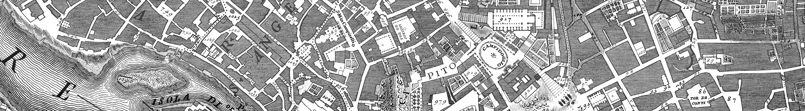
Like most colonial port cities, Singapore’s urban development is popularly interpreted as following the duality of European and non-European communities, segregated to ensure public order and the effective governance of the latter as a colonised workforce to serve the growth of a globalised colonial economy. Such rhetoric originated from the town plan that the colony’s founder conceived, known as the Raffles Town Plan, during his third visit in 1822. His scheme organised and materialised aspirations for Singapore to become ‘a place of considerable magnitude and importance … [requiring] an economical and proper allotment of the ground intended to form the site of the principal town’ (Buckley 1902: 81). The centrality of Singapore River on the map, flanked on both banks by residential and commercial enclaves, indicated its significance as Singapore’s communications and economic lifeline (Tanzer 1986; Hon 1990; Dobbs 2003; Auger 2015). Orthogonal plots divided proportionally between European and other immigrant communities created a false sense of equality, of shared, fair access to the vital waterfront. As Anderson argues, the map ‘worked on the basis of a totalising classification’, and the idealised cadastral plan became a widely regarded, if misconstrued, representation of omnipotent control and benevolent rule (2006: 173). This misconception of equality and order was perpetuated by successive governments in the way they valorised the city’s heritage, even though historical evidence reflected the contrary.
In the early 19th century, colonial control over urban development was neither absolute nor coordinated. Due to the colony’s status as a free port and a farflung dependency of the Bengal Presidency, it was allotted only a small number of EIC administrators and insufficient revenue to support infrastructure development.1 Furthermore, the settlement installed a municipal commission only around 1886, to regulate land ownership, construction, and town planning. Prior to that, the development of the port settlement was arbitrarily determined by commercial demands and land speculation. Rent-free location tickets and land grants were freely issued to merchants, in exchange for labour to clear land and construct embankments (Song 1923: 35). By the mid-1840s, this had resulted in an uncoordinated hodgepodge of masonry, also called ‘pukka-built’ (built of permanent material), godowns along the riverbank, a heterogeneity matched by the ethnic diversity of these buildings’ owners: regional merchants, like Naraina Pillai and Tan Che Sang, obtained plots next to British and Raj-based agency houses represented by A.L. Johnston and Alexander Guthrie (Walker 1865: 158). The racial multiplicity of the mercantile community was a distinctive factor in the colony’s economic success; J.T. Thomson, the government surveyor appointed in 1841, described how ‘subjects of nations at war are friendly here … bound hand and foot by the absorbing interests of commerce’ (1864: 16).
As the colony’s population grew, from 5,874 in 1821 to 181,602 in 1891, its corresponding prosperity fuelled feverish property speculation. Until the 1880s, land and properties along the river frequently exchanged hands through private deeds, leaving the government without effective control over building construction (Lo and Lim 2005: 222–23). Prized river-facing plots underwent cycles of partitioning into subdivided plots to build adjoining shophouses, each unit containing a narrow frontage of approximately 20 feet (Survey Department 1860s: SP000135). The Plan of the Town of Singapore of 1854 records a number of both large rectangular plots and plots of narrow strips, each land grant and their associated subdivided lots clearly labelled (Survey Department 1854). Regardless of the size of the lots, the buildings on them were all oriented towards the river, indicating the common function of processing goods unloaded from boats moored along embankments. The co-existence of large godowns in proximity to shophouses indicates the cooperation between established Western agency houses and small-scale regional traders, which defied the conventional perception of a competitive business environment where the size of a business premise indicated the importance of a business over its competitors.
Colonial administrators established a laissez-faire approach to real estate, complementary to its free port policy by which merchants were allowed to shape urban development through commercial and speculation opportunities (Turnbull 1989: 23–31; Wong 1991: 42–48). It was these economic forces, and not the colonial government’s racial segregationist policies and planning methods, that proved to be a predominant factor in the city’s physical growth. The colony’s success in transhipment propelled it to a ‘regional entrepôt on a global scale’ (Dobbs 2003: 9), with local and global economic trends intersecting and effecting consequential changes in how the city developed. Godowns became spaces that contributed to such developments and provided ‘cross-cultural contact zones’ where building craftsmanship drawn from migrant communities resulted in a synthesis of construction knowledge and the negotiation and adaptation of different techniques, tools, and materials for the service of mercantile demands (Chopra 2016: 278). Godowns were thus not an imported colonial architecture, a conclusion that challenges the cultural determinism of Singapore’s historiography.
Rejecting uncritical associations of building types with ethnicity, I instead draw upon Robin Evans’s analysis of how the evolution of house plans from the Renaissance to Victorian periods reflected changes in human relationships, interactions, and lifestyles (Evans 1997: 55–92). The relationship between space and users is inseparable, as Evans shows. A reading of godown plans likewise illustrates how functions and activities influenced design and spatial configuration. The earliest drawings of godowns in the National Archives of Singapore date to 1886, following the Municipal Commission’s stipulation that building plans had to be approved prior to construction (Turnbull 1989: 124). A number of godown drawings of godowns in the collection belonged to individual Chinese merchants who signed off on them, indicating personal involvement during the design process. In contrast, agency houses operated by expatriate managers never identified individual officeholders on their planning submissions. This difference on the plans for godowns under different types of management provides a unique way by which to consider how godown development was related to changes in Singapore’s entrepôt environment, a path that requires examining not just official reports but also biographies and the accounts of travellers.
Blurring the Boundaries between Residence and Godown
In the autobiography of Munshi Abdullah, The Hikayat Abdullah, the author talks about how early pukka-built buildings around Singapore River were used as godowns and residences and even for administrative functions. His observations disprove the claim that the Raffles Plan organised the development of the settlement into distinct mono-functional zones, particularly designating the river mouth as a trading port. Abdullah arrived in Singapore in June 1819, after the conclusion of the EIC’s treaty with Sultan Hussein that established a trading settlement on the island, and became an interpreter for Raffles at the young age of 24. The term ‘Munshi’, an honorific in Persian conferred upon well-respected teachers, acknowledged that Abdullah’s language skills were outstanding even at that age (Abdullah 1970: 1–28). From his privileged position, Abdullah documented the colony’s early establishment and made astute observations on various personalities central to this process. His work is a rare glimpse into the settlement’s early formation and reflects the young man’s amazement at the the multitude of building activities. Such activity was evidence of the port’s commercial potential, despite the founding administrators’ trepidation as uncertainty loomed over the viability of maintaining a British port within a region under Dutch influence.2
Such tension was also reflected in the disparity between residences constructed by colonial administrators and those by merchants. Abdullah expressed dismay that Raffles and Farquhar lived in houses made of attap and palm-netting walls, unbefitting of their status as EIC representatives (Abdullah 1970: 157–58). According to Abdullah’s descriptions, attap, a type of palm leaf used for roofing, provided scant protection against the island’s untamed environment. The porous coverings were prone to centipedes that dropped from roofs and ‘bit [residents] all over the place’, and panic ensued when, ‘after a night’s sleep, … large centipedes [were found] under one’s mat’ (Abdullah 1970: 147–48). The makeshift and flimsy residence Raffles constructed on Government Hill, the unofficial Governor’s House, continued to attracted ridicule when succeeding administrators took up residence. By the 1830s, the structure was described disparagingly as ‘so frail, people looked up after a stormy night to see if it was still there’ (Turnbull 1989: 45).
Abdullah’s description of masonry buildings was more favourable, as though the permanency of bricks and stone bestowed a sense of security and confidence for the nascent settlement. Such sentiments were shared by Singapore’s early mercantile residents; Raffles shrewdly encouraged land speculation to make Singapore’s commercial viability appear more attractive than it actually was (Abdullah 1970: 167–68). The first pukka-built building in the settlement was a residence originally commissioned by Mr Methven but converted into a prison in 1825 to house indentured convicts from India (Abdullah 1970: 167; McNair 1899; Pieris 2009). Surprisingly, the adjoining courthouse and police station remained timber structures until 1830. Through Abdullah’s recollections, it is evident that early pukka-built structures were appreciated not only as status symbols but also for their solidity that created an impenetrable barrier between interior and external environments. Subsequent masonry residences built by Western merchants would perform a similar function but for dissimilar purposes.
By 1830, a 9-acre area surrounding the Esplanade on the north side of the river was highlighted as a landmark that gave ‘the town its present fine appearance’. Governor Fullerton stipulated that buildings surrounding the field be designed uniformly in ‘an ornamental style of architecture’ (Cameron 1865: 19–20), which owners interpreted as Palladian-like residences with colonnade porches capped with triangular pediments (Figure 1).3 In the late 19th century, some residences were still standing in the area, before stricter planning enforcement reverted these sites back to the area’s intended administrative use. The only building that remains today, possibly the oldest masonry building in Singapore, is the Parliament House, built in 1827 as a two-storey residence with godown space. It was designed by Singapore’s first superintendent of Public Works and Prisons, G.D. Coleman, for John Maxwell, a Scottish merchant, who never resided there because of the area’s administrative zoning, despite having obtained permission from the Bengal Presidency to claim ownership over the property. In June 1827, Maxwell instead rented out the building for use as the colony’s courthouse. It underwent subsequent rounds of expansion to become the Legislative Assembly in 1955 and later the Parliament House after independence in 1965. It is currently used as a cultural venue. The plan drawing of the original residence challenges the sanctity of Western architectural style and monofunctional residential use (Figure 2). Its internal three-bay configuration, with small rooms arranged around a central hall, resembled the 18th-century compound houses in Calcutta. These houses were opulent examples of bungalows popular with middle-class natives, derived from ‘Indian houses with single-loaded rooms around a courtyard within the geometry of a single roofed entity’ (Chattopadhyay 2005: 120).
Buildings in Singapore from the seafront of Padang, ca. 1837, showing the Palladian references recommended by Governor Fullerton. View of Protestant Church (right) (Voyage autour du monde, 1837: plate 47). National Museum of Singapore, available through the National Archives of Singapore, Accession No. 128537, https://www.nas.gov.sg/archivesonline/photographs/record-details/ad5c305f-1161-11e3-83d5-0050568939ad.
Ground-floor plan of Maxwell House, later renamed Parliament House, showing the original 1827 plan and subsequent expansions from 1955 and 1965. Drawn by Ian Tan based on a drawing in Parliament House Preservation Guidelines (Preservation of Monuments Board 2003: 24).
The similarity in plan between Parliament House and bungalows in Calcutta is not surprising, as Coleman had practised architecture in Calcutta before arriving in Singapore (Seow 1967; Hancock 1986; Lim 1993). Further amalgamation of timber construction techniques, the use of imported regional materials such as ‘Portuguese’ bricks from Malacca, and the involvement of Indian builders and Chinese carpenters created a unique appropriation in such European residences that reflected local architectural adaptations (Lee 1989: 21). The spatial configuration of the residence centred around a large hall serving as the main circulation space, and smaller peripheral rooms used as bedrooms or offices. Such configurations persisted well into the 20th century, suggesting not only similarities in the environmental and social conditions of both Singapore and Calcutta, but also how spatial configuration became an architectural strategy to address exigent conditions.
For instance, early residences for Western/European merchants were designed not as family houses but rather as mixed-use domicile and workplaces, since European traders perceived themselves as sojourners seeking trade opportunities overseas. The central hall served as gathering place where guests mingled and were entertained, without trespassing into spaces for individual use. The clear delineation of circulation for public and private users, manifested through the spatial hierarchy of central and peripheral spaces, suited the building’s new purpose as a courthouse. Another salient building feature, the main living quarters raised on brick columns to create a low-ceilinged ground-floor level, reflected the fear, common amongst Europeans living in the tropics, of miasmic diseases spread through damp air rising from the ground. Lifting the main living quarters became essential to create healthy quarters. The uninhabited ground level was put to use as a godown for storing and trading commodities. The term here denoted a storage space within a building rather than a building designated for storage, derived from the term’s use in South Asia (Chattopadhyay 2005: 97; Glover 2008: 10). Its multi-purpose use led a Madras artillery officer, P.J. Begbie, to assume these residences were ‘fine-looking European shops’ where ‘nearly everything requisite can be procured’ (1834: 351).
Entrepôt Trade and Godown Development
While Begbie’s description established the relationship between residential and commercial functions of a European residence — both house and godown — that relationship is inadequate for explaining how such a godown contributed to the colony’s fourfold increase in trade value from 1823 to 1866 (Wong 1960: 124). Most Western agency houses dealt only with transhipping raw materials and manufactured goods rather than entering the labour-intensive entrepôt trade, which involved grading, processing, and repackaging a commodity to increase its value (Wong 1991: 59). Operating largely on reputation and business networks, agency houses reaped lucrative returns for successful deals with British and overseas agency houses. Not only did such trading incur low operating costs, since it was carried out inside residences, but negligible amounts of money changed hands, too, as goods were disposed on credit or bartered for other commodities (Wong 1960: 163). By 1840, the variety of goods passing through Singapore had increased exponentially. That year, The Tabular Statements of the Commerce of Singapore listed more than 100 items imported and exported via Singapore, including produce such as bird’s nest, sago, and spices, which required extensive processing. Local merchants leveraged Singapore’s strategic location between two oceans to develop the colony into a clearing house for entrepôt trade, and in the process, transformed godowns from mere storage spaces into production factories (Holloway 1842: 2–5).
Entrepôt trade was not foreign to Singapore before colonial rule. Archaeological evidence reveals that Chinese-dominated entrepôts had existed around the Malaccan Straits since the Ming dynasty (Leong 1990: 17–38). Overseas Chinese enterprises traditionally revolved around a bang, or kinship system, exclusive to merchants sharing common ancestral origins to divest business risk (Yen 2014: 285–93). Affiliated traders across Sumatra, Borneo, and Malaya collected produce from native planters and sent it to Singapore for processing and sale. Only a supercargo (a specific type of shipping officer, also known as ‘chinchew’) from the same bang would be entrusted with collecting and protecting produce from port to port to further minimise the risk of anyone absconding with valuable produce.
By the 1850s, Western agency houses, rather than Chinese merchants, were beholden to this relationship. John Thompson, a Scottish photographer known for his expeditions throughout Asia, observed how Chinese traders had become ‘indispensable as they established connections in almost all the islands to which our foreign commodities are carried … [I]n this way much of the produce shipped to England and other foreign countries, passes through the hands of Chinese middle-men’ (1875: 11–12). By then, most agents sought to develop long-term working relationships with local-born Chinese, known as Peranakans, a Malay term that literally means ‘children of the land’. The local community, the offspring of early merchants from coastal Chinese cities and local women, retained its Chinese linguistic and cultural roots by using dialects such as Hokkien (Fujianese) and Teochew (Chaozhou) and observing ancestral worship in everyday life, even as families incorporated aspects of European lifestyles through the education provided by colonial institutions and missionaries. The Peranakans’ proficiency in Malay, English, and European languages and their ability to organise the sinkheks, or migrant workers, from their ancestral hometowns made them indispensable to agency houses. ‘Loyal’ Peranakan merchants were rewarded with generous upfront payment before the delivery of produce. They thus had cash for dabbling in property speculation and port-related ventures like freighting and ship chandelling, businesses that accumulated more wealth even before payments were made to planters and affiliated regional traders (Wong 1960: 168).
One of the best-known partnerships was between Edward Boustead, founder of Boustead & Co., and Tan Kim Seng, a prominent merchant and leader of the Chinese community in the mid-19th century. Their close business affiliation is aptly represented by the adjacent location of their godowns along Boat Quay and the design similarities those godowns shared, particularly the double-storey Doric columns fronting the façade along Battery Road and Boat Quay, earning the resulting unified structure the sobriquet ‘House of Seven and Twenty Pillars’ (Buckley 1902: 208) (Figure 3). The commencement of their cooperation around 1837 coincided with Boustead’s merger with Schwabe & Co., a Liverpool-based export company. The combined company, Boustead, Schwabe & Co., specialised in the shipping of manufactured products, such as textiles, biscuits, brandy, and steel, from Liverpool to Singapore, Hong Kong, and Manila, and the export of regional produce back to Britain (Buckley 1902: 207–8). By that time, Tan’s spice business, the eponymous Kim Seng & Co., also known as Chop Hong Hin, or fengxin (豐興), had been thriving for a decade. As a third-generation Malaccan Chinese, Tan benefitted from deep kinship ties across the region, which facilitated access to the spices sought by agency houses. This partnership allowed Tan to expand his business and increase his public profile, which not only consolidated his family’s leadership over the Eng Choon bang, but also accorded him recognition as the de facto Chinese community leader (Yen 2014: 288–93; Ke 1995: 81).
Boat Quay on Singapore River. To the right of the truss bridge in the midground are the two adjoining godowns, which appear indistinguishable in this view of the continuous façade connecting them. The one closest to the bridge belonged to Edward Boustead and the other to Tan Kim Seng (Bickmore 1868: 520).
The pinnacle of Tan’s success in Singapore is epitomised by his hosting of the first-ever gala ball organised by a Chinese merchant. The event was held at his Boat Quay godown instead of a ballroom that some thought would befit his status as Chinese leader. Despite the building’s utilitarian connotations, the upper floor overlooking Singapore River was spacious and luxurious enough to entertain Tan’s distinguished guests. A lively account of the event on February 21, 1852, was published in Household Words, a popular Victorian miscellany founded by Charles Dickens that middle-class intellectuals in Britain and overseas followed. The author, James Augustus St John, vividly described the ballroom of the godown as ‘no smaller than the body of a good-sized English church, with a row of pillars under the galleries, behind which spectators thronged’. The cosmopolitan nature of the colony was reflected in the cuisine served, which St John described as a ‘chaos of dainties’ with ‘bird’s-nest soups, puppy ragouts, pillaus of kangaroos’ tails, fish of all kinds, and pastry in profusion’ (St John 1852: 331–32). It offered a glimpse of the multitude of produce available then and also the resources available to Tan through a vast shipping network that traversed two oceans.
Not much is known about the configuration of Tan’s godown, save for St John’s brief descriptions of the interior interspersed within his article. Yet its prominence along Boat Quay and its longevity — it lasted for more than a century, until 1975 — meant historians would often mention it in fleeting descriptions of Singapore River. One described the godown as ‘big, well-ventilated, dry, clean and built for easy access to tongkangs, with simply-designed facades … double-storeyed Doric columns, rounded arches, tall windows, entablatures and Chinese roof tiles in Palladian symmetry adapted to the tropical merchant milieu’ (Kong 2011: 123). Another believed the architect to be Coleman, based on ‘the graceful colonnade of arches which rose through to the upper storey’, and applauded his ingenuity in ‘elevating a mundane warehouse … to a building of distinction’ (Beamish and Ferguson 1985: 44). Looking at picturesque photographs of the past, historians often labelled the building as an ‘Anglo-Oriental warehouse’ (Tyers 1976: 20). Such a hyphenated term not only privileges Western denominators of architecture in colonial settings, but it also superficially acknowledges the incongruency of such architecture outside temperate environments, which necessitated localisation through building materials and construction techniques. In the same way, 19th-century residences built for Western merchants have been categorised as Anglo-Indian or Anglo-Singapore hybrids, without justification. Architectural historians like Jon Lim use the term ‘Anglo-Singapore’, while Julian Davison devises terms such as ‘Anglo-Indian Regency’ and ‘Anglo-Malay’ to describe the styles of early residential houses without explaining why these terms were adopted (Lim 2001: 170; Davison 2006: 10–16).
Based primarily on its façade, Tan’s godown was likewise categorised arbitrarily as an example of ‘Anglo’ architecture, despite obvious differences in building layout and roof enclosures compared to Palladian-like residences built in the same period. Aerial photographs taken in 1950s revealed the godown’s U-shaped configuration with three adjoining rowhouses around an open-air courtyard.4 This configuration differed from the hip-and-valley roof of the Parliament House that followed the contours of the room layout. Having a roof is obviously necessary to keep occupants safe and dry. Likewise, the segregation of outdoor and indoor spaces within a godown is significant to the types of functions it performed. Given Tan’s background as a spice trader, one can speculate that the upper storeys provided offices and workers’ accommodations while the open courtyard and enclosed ground-floor spaces were used for drying, grading, and storing spices. These processes had to be conducted away from the prying eyes of competing merchants (Chng 1986: 1–12).5
From Multipurpose to Purpose-Built Godown Factories
In the 1890s, many drawings of low-rise godown compounds of L-shaped, O-shaped, and U-shaped configurations surrounding open-air courtyards were submitted to the Municipal Commission. The courtyards are often labelled as drying yards or washing areas. These late-19th-century godowns made use of the abundant space available in secondary settlements a short distance away from the Singapore River, connected via trunk roads and subsidiary waterways. In the early 19th century, secondary settlements appeared on former gambier and pepper plantations along River Valley Road, Bukit Timah Road, and Selegie Hill in response to growing demands for gambier (a leather tanning agent) and pepper. The two crops shared a symbiotic relationship, as gambier was a natural fertiliser for pepper. Early Teochew sinkheks, led by Peranakan compatriots, arrived in large droves to cultivate these crops.
By 1836, there were at least 250 gambier plantations, employing approximately 2,350 Chinese workers. Twenty years later, in 1856, these figures had more than doubled; 543 plantations employed almost 5,000 workers and accounted for three-quarters of the cultivated land on the island and three-fifths of agricultural exports (Tan 2018: 52). Accompanying the growth of gambier and pepper plantations were industrial spaces for processing. The prevailing labour conditions, such as the lack of easy access to the commercial district from rural plantations and the urgency to extract gambier juice from plucked leaves immediately after harvesting, led to the construction of multi-purpose godowns combining factory space and dwelling space for workers.
Despite the considerable income generated from the two crops, gambier was notorious for exhausting the land. A gambier plantation lasted twenty years on average, so demand for new sites, along with soil depletion, resulted in the abandonment of old plantations and the intense clearing of jungle land (Phua 1950: 32). Arable land had run out by the late 19th century, forcing gambier to be planted farther into the Malayan peninsula, leaving behind tracts of abandoned but cleared land for sale. Former plantations close to the port were auctioned off and progressively developed into urban settlements to cope with the colony’s population increase, while farms farther inland introduced a new pair of cash crops, rubber and pineapple, which would further boost Singapore’s trade.
Introduced in 1888, rubber, a plant native to the Amazonian forest, would be not only pivotal to a new wave of Singapore’s economic growth in the early 20th century but instrumental in the next stage of godown conversion, from storage space to full-fledged factory. Rubber plantations were established rapidly in the 1900s, mostly by Chinese merchants, on large tracts of former gambier plantations. Like pepper, pineapple was found to be compatible for double-cropping, in this case with rubber. Though considered of lower value, pineapple, harvested 18 months after planting, provided substantial revenue in the five years of growth rubber trees needed before their latex could be harvested. Every acre of farmland provided 4,000 or 5,000 pineapples. Global demand for pineapple took off after industrial canning methods were introduced that prolonged its shelf life. Singapore emerged as a major production centre for canned pineapple, second only to Hawai’i in export volume (Pineapple Conference 1931: C231).
Despite pineapple’s obvious economic significance, plantation owners and cannery operators, predominantly Chinese entrepôt merchants, regarded the crop as only a ‘by-product of the rubber industry’. This attitude led to business practices that ran contrary to the colonial government’s dedication to modernising the pineapple industry. The government encouraged plantation owners to treat pineapple as a primary crop and thus to invest more effort in improving its quality. A report in 1931, supported by scientific research, projected lucrative returns and urged canneries to mechanise operations to compete with the ‘highly ingenious machinery’ used in Hawai’i (Pineapple Conference 1931: C220). The report also mentioned small-scale canneries found in godowns, many established as ad hoc businesses to cash in on the crop’s profitability, and denounced these speculative operations as the main reason for the commodity’s low quality (Pineapple Conference 1931: C225).
What colonial authorities saw as factors inhibiting the growth of Malaya’s pineapple industry were in fact emblematic of diversification strategies adopted by Chinese merchants to minimise risks from overexposure to a single commodity amidst a competitive entrepôt market. Some mitigation manifested as architectural strategies to adapt to rapid changes in entrepôt trade. For godowns, adaptations entailed standardised construction — framing of rectilinear timber or cast-iron, with infill panelled walls and pitched truss roofs for easy dismantling and reconfiguring elsewhere to accommodate new industrial processes. This type of construction was especially prevalent during the early days of the pineapple canning trade, as observed in Tan Tye’s godown, constructed in 1886 at Clarke Quay, an industrial area on the upper reaches of Singapore River. The plan for five interconnected single-storey units was conspicuously simple (Figure 4). The most prominent features were its oversized jack roofs, with openings through which heat could dissipate, and deep overhanging eaves extending out to a pier. These features indicated the need to keep commodities away from the elements, but the drawing otherwise provides no details about the function of such a structure. In historical anecdotes, vague references appear about a few pineapple canneries located in Clarke Quay during the late 19th century. As Tan Tye was often cited as a forerunner of the pineapple trade, it was no surprise that Tan Tye’s godown in Clarke Quay was renamed The Cannery following its restoration in the 1990s. However, given Tan’s business interests not only in pineapple canning but also in timber trading and freighting, the godown might have been used for storing and processing different commodities in addition to pineapples (Ke 1995: 88).
Plan of Tan Tye’s godown submitted in 1886. Proposed Godown for Mr Tan Tye, Collection of Building Control Division, National Archives of Singapore, Singapore, Accession No. 109/1886.
Chinese merchants had no incentive to invest in the expensive machinery pioneered in the Hawaiian pineapple factories of Dole and Libby; Singapore’s large migrant labour force could be trained to can manually. An interview conducted with a former pineapple cutter indicates how entrenched such practice was up to the 1940s:
200 people working all in different sections. The pineapple cutters are the most. Then there is another section. They put this syrup into the tin. Then after that another section will seal up the tin. Then they go to the heater. They heat the tin up so that it becomes a sort of a seal with the preservative inside there. Then after that it goes to another department to put the label on. Then finally pack into cases like that for export. Like that the factory will have at least about 200 people and mostly men working. (Tay Meng Hock 1984)
Godowns designated as permanent pineapple canneries, rather than the ad hoc ones popular in the preceding decades, dominated the industry from the 1900s onwards, as canning production was consolidated in a few companies that could achieve international reputations and economies of scale (Song 1923). A crucial factor was that canneries had to be located near the waterfront, since every day up to 60,000 fresh pineapples were transported by boat to canneries for processing. Industrial modernisation for such canneries is not measured by the extent of mechanisation but by the level of sophistication and efficiency in spatial configuration; for example, spaces dedicated to different functions helped to streamline the canning process. Two plan drawings for new pineapple godowns, one attributed to Tan Tye’s son, Tan Lian Boh, and the other to the family’s business, Hin Choon & Co., were submitted in 1906 and 1907 respectively (Figures 5 and 6). After Tan Tye’s death in 1898, his sons, Tan Lian Boh and Tan Lian Chye, chose to abandon the timber trade to focus on pineapple cultivation and canning.6 Two adjoining compounds were established on Sumbawa Road outside Kampong Glam, which marked the easternmost boundary of the Raffles Town Plan and was in proximity to the shore.
Plan for pineapple factory at Sumbawa Road for Tan Lian Boh. Drawn by Ian Tan based on plan drawing in the collection of Building Control Division. Property of Mr Tan Lian Boh, 1906, National Archives of Singapore, Singapore, Accession No. 8232/1906.
Plan for pineapple factory at Sumbawa Road and Victoria Street. Drawn by Ian Tan based on plan drawing in the collection of Building Control Division. Property of Messer Hin Choon & Co., 1907, National Archives of Singapore, Singapore. Accession No. 677/1907.
The newly built cannery was considered the most modern in Malaya. A publication from 1908, Twentieth Century Impressions of British Malaya, provides photographs and a glowing description of it (Wright and CartWright 1908: 657). A photograph of the façade of the godown and factory compound shows a sheltered veranda, or ‘five-foot way’, supported on square piers typical of two-storey shophouses from the early 20th century (Figure 7). The lack of openings on the ground floor, however, hints at its industrial function rather than the retail and residential functions of a shophouse. In addition to the decorative facade and use of masonry for the street-facing building, the cannery’s permanency is also reflected in written specifications on the plan drawings, such as enclosed spaces that had to be ‘lain in concrete and rendered with good Portland cement’. Such costly construction was uncommon for godowns; newly introduced material commanded a premium and required specialised workers to handle it. The screed flooring could be specified as a hygiene measure, as cement was considered impermeable and was therefore an effective barrier against disease-carrying vermin and miasma emitted from the ground.
Façade of Hin Choon & Co., with portraits of Tan Tye and Tan Lian Boh (Wright and CartWright 1908: 658).
The factory compound was composed of two parts. The two-storey building described in the plan attributed to Tan Lian Boh contained dwelling houses for workers, a storage shed for fresh and canned pineapples, a purpose-built boiler, and four steamers. Fuelled by discards from the pineapples, the boiler supplied steam through metal pipes to individual steamers that sterilised and sealed the canned pineapples hermetically. Once completed, cans were piled in honeycomb fashion before labelling and crating. The other part of the compound, detailed in the second plan for Hin Choon, comprised interconnected single-storey sheds with space for cutting pineapples and open-air courtyards containing water troughs for washing cut pineapples and filling cans with syrup. These would then be transferred to an adjacent area for soldering (Figure 8). The compound also allocated workshop space for making cans and wooden packing cases, although these processes were not essential to a cannery’s operation. Nonetheless, they emphasised the company’s self-sufficiency and provided a sense of its operational scale: in 1907, it produced three million cans of pineapples, about 10% of all Malayan pineapple exported (Wright 1908: 657).
Interior of Hin Choon & Co. Pineapple Factory, with the labels of canned pineapples they produced (Wright and CartWright 1908: 659).
Iron Skeletons and Modern Services
Tan Liah Boh’s factory compound, completed in 1907, may have been one of the last godowns approved to contain dwelling houses for workers within its compound. That year, Dr. William J.R. Simpson, professor of hygiene at King’s College, was appointed to investigate the sanitary conditions in Singapore and address the high mortality rate amongst Chinese sinkheks. Citing overcrowding and unsanitary housing as principal causes of endemic diseases, one of his recommendation called for ‘warehouses and godowns to be placed in a different category from dwelling houses’, suggesting the two functions be separated unless owners could conform to higher sanitation standards, with ‘proper drainage, scavenging and a free circulation of air’ for such dwelling houses (Simpson 1907: 30). The stipulation was enacted via a municipal by-law two years later, in 1909, even though arguments raised by municipal commissioners chiefly targeted the rampant practice of converting dwelling houses into godowns. Landlords not only charged tenants exorbitant rents for using shophouses for storing goods but, in doing so, also displaced hundreds of workers living inside partitioned cubicles (Municipal Commission 1909). Low-wage godown workers became collateral damage when workers’ accommodation provided by employers were revoked.
The differing perspectives revealed a common anxiety over the dire shortage of space within the commercial district, unable to fulfil a growing need, particularly around Raffles Square, for luxurious office accommodations that rose in tandem with Singapore’s increasing significance as a financial centre and shipping hub, and for godowns and industrial spaces to sustain essential maritime operations. Competing demands to accommodate burgeoning commercial and industrial activities within the tiny area of approximately 76 acres, located between the south bank of the river and the Chinese enclave, led to rife speculation on the limited available sites. By the early 20th century, much of the early settlement and commercial district had been transformed into ‘a solid array only for the elites’, as a newspaper editorial insinuated (‘Signs of the Times’, 1903). An uneasy compromise to solve the shortage of land was achieved architecturally. Multi-storey commercial buildings were developed that contained open-layout spaces for banks and shipping operations, offices offering professional services such as law and accountancy, and provisions for storage that complied with municipal requirements for redeveloping sites allocated for godown use (Chua 1989: 32–34).
Chinese merchants, many already owning godowns around Raffles Square, benefited from the lucrative opportunities of redevelopment. Old godowns, described as ‘ramshackle, white-ant eaten, leaking and badly lit’, were demolished en masse as Chinese merchants engaged well-regarded colonial architectural firms to build four-storey commercial buildings, following examples from renowned port cities like Liverpool and Manchester, which contained ‘healthy, sensibly arranged and well-lit’ interiors (‘Westward Ho!’, 1891), The design of these buildings were copied from their British counterparts, which in turn drew inspiration from palazzos built in famous Renaissance mercantile cities like Florence and Venice. British writers advised companies to emulate that style, a ‘worthy embodiment of modern commerce’, because of its connotations with such historical forms (Sharples and Stonard 2008: 34). Such public discourse on architectural symbolism was, however, non-existent in Singapore, and the widespread ‘Italian’ design idiom for mixed-use godowns built in the early 1900s was mainly adopted to fulfil the Municipal Commission’s expectations for a harmonised ‘classical’ street façade in the commercial district, as well as to create designs outlandish enough to attract well-paying tenants. The primarily British composition of the Municipal Commission skewed preference towards Neoclassical buildings (‘The Municipal Commissioners’, 1890: 14).
Self-made entrepreneurs, such as mining magnate Loke Yew, were eager to enter the top echelon of Singapore’s mercantile establishment and would spend exorbitant amounts to develop their properties as signs of their abundant wealth and optimism for the colony’s development. Loke successfully bid for 16 Collyer Quay, a waterfront site next to Hongkong and Shanghai Bank, in September 1900. He then commissioned Swan and Maclaren, the foremost architectural practice at that time, to design a new four-storey commercial building, initially named Loke Yew Building and later christened Winchester House (‘Valuable Property Sale’, 1900: 3) (Figure 9). When it opened in 1905, it offered a full suite of modern amenities, such as electric lighting and lavatories on every floor; over the years it was occupied by a number of prominent companies. Singapore’s first electric passenger lift was installed in Winchester House in 1906. An additional lift, the ‘fastest running lift in Malaya’, was installed in 1910; it directly connected the ground lobby to the top floor, instead of stopping at every floor (‘Commercial Developments’, 1914: 7).
Ground-floor plan of Winchester House. Drawn by Ian Tan based on plan drawing in the collection of Building Control Division. Towkay Loke Yew 16 Collyer Quay, 1903. National Archives of Singapore, Singapore. Accession No. 6422/1903.
Other leading merchants from Peranakan families likewise redeveloped their family properties in the commercial district, capitalising on new construction systems to increase the number of floors and thus leasable area. For Tan Jiak Kim, the grandson of Tan Kim Seng and a director of Kim Seng & Co., a fortuitous fire in 1893 provided not only the opportunity to redevelop his damaged godown into a modern commercial building but also to convince neighbouring building owners on the same block facing the same predicament to sell their godowns to him (‘Disastrous Fire in Singapore’, 1893). Bonham Building, an ornate and imposing three-storey godown and office building fronting a key thoroughfare leading to Raffles Square, emerged on the amalgamated site around 1900 (Figure 10). The ground and first storeys were rented to anchor tenants such as Katz Brothers, a German departmental store popular until World War I, when it was seized as enemy property. The Yokohama Specie Bank took over the space in the 1920s, followed by United Overseas Bank from 1935 to 1973. The building’s tall ceiling was used to dramatic effect, enhanced by a row of double-height masonry columns in the entrance lobby, creating grand airy rooms befitting their functions and the exclusive clientele they served.
Partial ground-floor plan of Bonham Building at the corner of Bonham Street and Chulia Street. Drawn by Ian Tan based on plan drawing in the collection of Building Control Division. Godown and Offices Property of Tan Jiak Kim Esq., 1896. National Archives of Singapore, Singapore. Accession No. 1123B/1896.
The modern building features found in Winchester House and Bonham Building were made possible by structural iron frames, consisting of cast iron H-section and box section stanchions supporting I-section beams of mild steel. Even though cast iron columns were used to support timber beams and roof trusses before the 1880s, no substantial attempts were made locally to exploit its structural properties until the introduction of the structural iron frame that allowed architects to design without the constraints of load-bearing walls and intrusive internal configuration. The construction system gained popularity in Britain around the late 1880s and was soon exported overseas.
In Singapore, the use of iron produced column-free godown spaces that changed how the building type was organised and deployed on tight, irregular urban sites. Iron offered advantages for storage facilities, the most important being the material’s supposedly incombustibility, a property often touted in manufacturers’ catalogues and advertisements. Fires were a constant threat to flammable goods. The risk was exacerbated by the cheek-by-jowl arrangement of buildings within the commercial district, which allowed fire to spread across adjoining properties despite the construction of masonry party walls. The superior spanning and loading properties of iron over timber also removed the need for cumbersome interior load-bearing walls, allowing flexible spatial configurations to accommodate both large-size companies, taking up an entire floor, or individual proprietors renting partitioned rooms. The decades-long role of Bonham Building as a banking hall, despite the industry’s rapid changes in services and technologies throughout the 20th century, is a testament to the building’s adaptability. Its layout was reconfigured to separate served and service spaces and to designate circulation for staff and public to optimise operational efficiency and security. Another key advantage the two buildings had over other mixed-use godowns were their modern amenities. Bonham Building and Winchester House were amongst the earliest to introduce the lavatories and lifts that are taken for granted today (BCD 1906; BCD 1910). Interestingly, lifts and toilets were only added to Winchester House in 1906 and 1910 respectively. At the turn of century, rapid improvements in building and sanitary technologies were facilitated by the structural iron frame that provided flexibility and sufficient loading capacity to accommodate drastic changes, such as reconfiguring a rear staircase core into toilets (BCD 1910).
Conclusion
The word ‘godown’ remained in use as the official nomenclature for storage buildings on drawing submissions to the Municipal Commission up to the 1950s (Cheong 1992: 19–20). However, as this essay suggests, the type itself had undergone significant changes since the first structures used as godowns were built along the colony’s waterfront almost two centuries ago. The use of the term, in both government parlance and popular use, ended abruptly after 1958 with the implementation of a masterplan, prepared by British experts, to guide long-term development for a post-colonial Singapore (Koh and Lim 1969: 317–18). The term ‘godown’ was replaced on plans with ‘warehouse’ and other narrowly defined functional categories such as ‘shopping’ and ‘business office’. In one fell swoop, the mixed-use commercial district was arbitrarily partitioned into three zones, each designated under one of three definitive categories. This inevitably contributed to the area’s Janus-like quality in the mid-1970s, as the post-independence government phased out the entrepôt trade and cottage industries that the colonial government had depended on for more than 150 years, and instead promoted industrial-scale manufacturing and container shipping as engines of the country’s future economy (Dobb 2003: 107–11). By the 1980s, the contrast between derelict godowns along a putrid river and the towering skyscrapers and podium malls of a finance- and service-oriented economy was a portend of the inevitable clearance of century-old godowns as part of urban renewal.
Although etymologically similar, a ‘warehouse’ clearly does not share the rich meanings and values a ‘godown’ embodied in the different stages of Singapore’s mercantile trade development. In the context of colonial Singapore, the building type neither conformed to the stereotype of a monofunctional storage space nor served as a static representation of the archaic business practices that historians have depicted as corollary to its demise (See Hon 1990; Berry 1982). Instead, the analysis of submission plans reveals a robust building type that served as storage space, its primary function, but shaped by speculation practices and evolving mercantile activities, with continuous adaptations and innovations in space and structure that corresponded to changes in housing and industrial requirements. It is a product of both the weak control municipal authorities held over privately owned sites in the 19th century and the free port’s laissez-faire policy that allowed merchants to shape the development of Singapore’s commercial district spontaneously through cycles of speculation and development. As a type, a godown is not affiliated with one ethnic group nor does its design conform to historical styles commonly found in the semiotic analysis and architectural narratives of shophouses and other civic buildings in Singapore. Instead, the key architectural considerations for a godown were decidedly pragmatic and speculative, as modern building materials, technologies, and design were employed to mitigate perennial anxieties over the security and safety of commodities it contained and to facilitate the work of people utilising and customising these spaces found across port cities.
Notes
- Three port cities, Singapore, Penang, and Malacca, formed the Presidency of the Straits Settlements in 1826 under EIC rule. This was abolished in 1830 and the Straits Settlements became a residency under the Presidency of Bengal, which came under the rule of the governor-general of India in Calcutta, the capital of Bengal. The Straits Settlement subsequently became a crown colony in 1867. [^]
- The status of Singapore as an EIC trading settlement was only confirmed in March 1824, after the signing of the 1824 Anglo-Dutch Treaty, which drew an invisible line demarcating the spheres in Southeast Asia of British to the north of the Singapore Straits and Dutch to the south. [^]
- Historians have used the terms Palladian, Regency, and Neoclassical to describe these houses (Majorie Doggett 1957; Gretchen Liu 1996; Jon Lim 2001). [^]
- See, for example, the photograph, Accession No. 151103, from the Public Works Department of 1954 on the National Archives of Singapore site, https://www.nas.gov.sg/archivesonline/photographs/record-details/b2b439af-1161-11e3-83d5-0050568939ad. [^]
- Of the 83 business holdings along Boat Quay in the 1880s, 14 were gambier, pepper, and spice traders. [^]
- Tan Lian Boh, also known as Tan Cha Boh (陳連畝), was the main partner in Hin Choon & Co. His brother, Tan Lian Chye, also known as Tan Chor Lam (陳楚南), was heavily involved in Sun Yat Sen’s revolutionary efforts. See Ke (1995: 88, 95). [^]
Competing Interests
The author has no competing interests to declare.
References
Abdullah, AK. 1970. The Hikayat Abdullah: An Annotated Translation by A.H. Hill. Singapore: Oxford University Press.
Anderson, B. 2006. Imagined Communities: Reflections on the Origin and Spread of Nationalism, Revised Edition. London and New York: Verso.
Auger, T. 2015. A River Transformed: Singapore River and Marina Bay. Singapore: Urban Redevelopment Authority.
Beamish, J and Ferguson, J. 1985. History of Singapore Architecture. Singapore: Graham Brash.
Begbie, PJ. 1834. The Malayan Peninsula. Madras: Vepery Mission Press.
Berry, L. 1982. Singapore’s River: A Living Legacy. Singapore: Eastern Universities Press.
Bickmore, AS. 1868. Travels in the East Indian Archipelago. London: J. Murray. DOI: http://doi.org/10.5962/bhl.title.96959
Buckley, CB. 1902. An Anecdotal History of Singapore. Vol. 1. Singapore: Fraser & Neave.
Cameron, J. 1865. Our Tropical Possessions in Malayan India. London: Smith, Elder and Co.
Chang, JH. 2016. A Genealogy of Tropical Architecture: Colonial Networks, Nature and Technoscience. London and New York: Routledge. DOI: http://doi.org/10.4324/9781315712680
Chattopadhyay, S. 2005. Representing Calcutta: Modernity, Nationalism, and the Colonial Uncanny. London and New York: Routledge. DOI: http://doi.org/10.4324/9780203086834
Cheong, C. 1992. Framework and Foundation: A History of the Public Works Department. Singapore: Times Editions.
Chng, DKY. 1986. 1880 年代的勿基 (1880 Niándài de wù jī, Boat Quay in the 1880s). 新加坡華人史論叢 (Xīnjiāpō huárén shǐ lùn cóng, Collected Essays on Chinese in Nineteenth Century Singapore). Singapore: South Seas Society.
Chopra, P. 2011. A Joint Enterprise: Indian Elites and the Making of British Bombay. Minneapolis: University of Minnesota. DOI: http://doi.org/10.5749/minnesota/9780816670369.001.0001
Chopra, P. 2016. South and South East Asia. In: Bremner, GA (ed.), Architecture and Urbanism in the British Empire. Oxford: Oxford University Press. pp. 278–317. DOI: http://doi.org/10.1093/acprof:oso/9780198713326.003.0009
Chu, C. 2012. Between Typologies and Representation: The Tong Lau and the Discourse of the ‘Chinese House’ in Colonial Hong Kong. In: Rajagopalan, M and Desai, M (eds.), Colonial Frames, Nationalist Histories: Imperial Legacies, Architecture and Modernity. Farnham Surrey: Ashgate. pp. 253–83.
Chua, BH. 1989. The Golden Shoe: Building Singapore’s Financial District. Singapore: Urban Redevelopment Authority.
Davison, J. 2006. Black and White: The Singapore house, 1898–1941. Singapore: Talisman.
Disastrous Fire in Singapore. 1893. The Straits Times (Weekly Issue), November 21, p. 4.
Dobbs, S. 2003. The Singapore River: A Social History 1819–2002. Singapore: NUS Press.
Evans, R. 1997. Figures, Doors and Passages. In: Translation from drawing to building. Cambridge, MA: MIT Press. pp. 55–92.
Glover, WJ. 2008. Making Lahore Modern: Constructing and Imagining a Colonial City. Minneapolis: University of Minnesota Press.
Holloway, CP. 1842. Tabular Statements of the Commerce of Singapore During the Years 1823–24 to 1839–40 Inclusive. Singapore: Singapore Free Press Office.
Hon, J. 1990. Tidal Fortunes: A Story of Change: The Singapore River and Kallang Basin. Singapore: Landmark Books.
Hornaday, WT. 1885. Two Years in the Jungle: The Experience of a Hunter and Naturalist in India, Ceylon, the Malay Peninsula and Borneo. New York: Charles Scribner’s Sons. DOI: http://doi.org/10.5962/bhl.title.48443
Ke, ML (柯木林 Kua Bak Lim). 1995. Xīnhuá lìshǐ rénwù lièzhuàn 新華歷史人物列傳 (Biographies of Singapore Pioneers). Singapore: Singapore Federation of Chinese Clan Associations.
Kong, L. 2011. Conserving the Past, Creating the Future: Urban Heritage in Singapore. Singapore: Urban Redevelopment Authority.
Leong, SH. 1990. Collecting Centres, Feeder Points and Entrepôts in the Malaya Peninsula, c. 1000 BC–AD 1400. In: Kathirithamby-Wells, J and Villiers, J (eds.), The Southeast Asian Port and Polity: Rise and Demise. Singapore: Singapore University Press. pp. 17–38.
Liu, G. 1984. Pastel Portraits: Singapore’s Architectural Heritage. Singapore: Singapore Coordinating Committee.
Lo, WP and Lim, JH. 2005. The Development of Land Registration in Singapore. In: Tan, K (ed.), Essays in Singapore Legal History. Singapore: Singapore Academy of Law & Marshall Cavendish Academic.
McNair, JFA. 1899. Prisoners Their Own Warders. Westminster: Archibald Constable & Co.
Nelson, LP. 2016. Architecture and Empire in Jamaica. New Haven and London: Yale University Press.
Phua, CL (潘醒农). 1950. Mǎ lái yà cháo qiáo tōng jiàn 馬來亞潮僑通鑑 (Chronicle of Teochew Chinese in Malaya). Singapore: Nándǎo chūbǎn.
Pieris, A. 2009. Hidden Hands and Divided Landscapes: A Penal History of Singapore’s Plural Society. Hawai’i: University of Hawai’i Press. DOI: http://doi.org/10.1515/9780824862831
Preservation of Monuments Board. 2003. Parliament House Preservation Guidelines. Vol. 1. Singapore: Preservation of Monuments Board.
Roskam, C. 2019. Improvised City: Architecture and Governance in Shanghai, 1843–1937. Seattle: University of Washington Press.
Sharples, J and Stonard, J. 2008. Built on Commerce: Liverpool’s Central Business District. Swindon: English Heritage.
Signs of the Times. 1903. The Straits Times, July 12, p. 8.
Simpson, WJR. 1907. The Sanitary Condition of Singapore. London: Waterlow.
Sinha, M. 2017. Godown. Journal of South Asian Studies, 40(2): 316–19. DOI: http://doi.org/10.1080/00856401.2017.1295206
Song, OS. 1923. One Hundred Years’ History of the Chinese in Singapore. London: John Murray.
St John, JA. 1852. A Chinaman’s Ball. Household Word, 117(5): 331–32.
Straits Settlements Legislative Council. 1931. Report of the Pineapple Conference, 31 Aug. In: Proceedings of the Legislative Council of the Straits Settlements with Appendix, 1931. Singapore: Government Printing Office. pp. C217–45.
Tan, GL. 2018. An Introduction to the Culture and History of the Teochews in Singapore. Singapore: World Scientific. DOI: http://doi.org/10.1142/10967
Tanzer, M. (ed.). 1986. Singapore Lifeline: The River and Its People. Singapore: Times Books International.
The Municipal Commissioners. 1909. The Straits Times, June 28, p. 10.
Thomson, JT. 1864. Some Glimpses into Life in the Far East. London: Richardson & Co.
Turnbull, CM. 1989. A History of Singapore, 1819–1988. Singapore: Oxford University Press.
Tyers, R. 1976. Singapore Then & Now. Vol. 1. Singapore: University Education Press.
Verne, J. 1881. Celebrated Travels and Travellers: The Great Explorers of the Nineteenth Century. London: Sampson Low, Marston, Searle & Rivington.
Voyage autour du monde: Exécuté pendant les années 1836 et 1837 sur la corvette La Bonite, commandée par M. Vaillant, capitaine de vaisseau. 1837. Photographs by Eydoux, F, et al. Paris: A. Bertrand. [Scans of plates are available at http://www.mediatheque-beziers-agglo.org/EXPLOITATION/Default/doc/IFD/FAE150/voyage-autour-du-monde-execute-pendant-les-annees-1836-et-1837-sur-la-corvette-la-bonite-commandee-p].
Walker, W. 1865. Jottings of an Invalid in Search of Health, Comprising a Run Through British India and a Visit to Singapore and Java, Bombay: Times of India Office.
Westward, Ho!. 1891. The Singapore Free Press and Mercantile Advertiser, September 21, p. 3.
Wong, LK. 1960. The Trade of Singapore, 1819–69. Singapore: MBRAS.
Wong, LK. 1991. Commercial Growth before the Second World War. In: Chew, ECT and Lee, E (eds.), A History of Singapore. Singapore: Oxford University Press.
Wright, A and Cartwright, HA. 1908. Twentieth Century Impressions of British Malaya: Its History, People, Commerce, Industries, and Resources. London: Lloyd’s Greater Britain Publishing Co.
Yen, CH. 2014. Ethnic Chinese Business in Asia: History, Culture and Business Enterprise. Singapore: World Scientific.
Yong, CF. 2013. Tan Kah Kee: The Making of an Overseas Chinese Legend. Singapore: World Scientific.